|
Coastal Regions & Maps
 Southeast Alaska
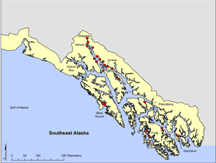
Southeast Alaska lies between the southern tip of Prince of Whales Is. to the far
edge of the Malaspina Glacier west of Yakutat Bay, a distance of 800 km. This region
is very complex with 33,600 km of shoreline and over 2,000 islands. The Tongass
National Forest, 17 million acres, covers more than 80% of Southeast Alaska. There
are over 5,000 glaciers in this region many of which spill into Glacier Bay National
Park.
There is a wide diversity of estuaries, fjords, bays, channels, and straits
found in Southeast Alaska. This region hosts some of the most diverse marine life
in all of Alaska.
<< back to Coastal Regions
|

