|
Coastal Regions & Maps
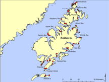
 Kodiak Archipelago
This region encompasses 13,000 square km and Kodiak Island is the second largest
island in the U.S. Exposed bedrock and shallow soils prevail along 4,000 km of rugged
coastline. Glaciers have left their mark with long, narrow fjords and U-shaped valleys.
1.8 million acres in the archipelago are part of the Kodiak National Wildlife Refuge.
Estuaries, lagoons, wetlands, tide flats, rocky islands, and sea cliffs host a plethora
of marine life in this region and exposed high-energy coasts are the dominate habitat.
<< back to Coastal Regions
|

